
File:20150319-Ceres-DwarfPlanet-Dawn-OpNav5HIPASS-QuadNames-blank.png

Size of this preview: 800 × 400 pixels. Other resolutions: 320 × 160 pixels | 640 × 320 pixels | 1,024 × 512 pixels | 1,280 × 640 pixels | 2,048 × 1,024 pixels.
Original file (2,048 × 1,024 pixels, file size: 390 KB, MIME type: image/png)
| This is a file from the Wikimedia Commons. Information from its description page there is shown below. Commons is a freely licensed media file repository. You can help. |
Summary
| Description |
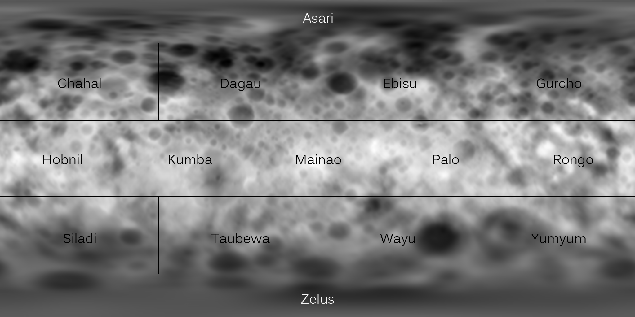
English: Topographic map of Ceres as of February 2015, without quad names. This map is a digital elevation model of Ceres made from Rotation Characterization 2 data gathered on February 19, 2015. Darker areas represent lower elevations, and brighter areas represent higher elevations. The map was originally posted here. |
| Date | |
| Source | http://www.planetary.org/blogs/emily-lakdawalla/2015/03191629-lpsc-2015-dawn-at-ceres.html (image link) |
| Author | NASA/JPL/UCLA/MPS/DLR/IDA/JohnVV/Emily Lakdawalla |
Licensing
| This file is in the public domain in the United States because it was solely created by NASA. NASA copyright policy states that "NASA material is not protected by copyright unless noted". (See Template:PD-USGov, NASA copyright policy page or JPL Image Use Policy.) | ||
 |
Warnings:
|
File history
Click on a date/time to view the file as it appeared at that time.
| Date/Time | Thumbnail | Dimensions | User | Comment | |
|---|---|---|---|---|---|
| current | 15:18, 22 June 2015 | | 2,048 × 1,024 (390 KB) | Huntster | =={{int:filedesc}}== {{Information |description={{en|1=Topographic map of Ceres as of February 2015, without quad names. This map is a digital elevation model of Ceres made from Rotation Characterization 2 data gathered on February 19, 2015. Darker are... |
File usage
The following pages on the English Wikipedia use this file (pages on other projects are not listed):
Global file usage
The following other wikis use this file:
- Usage on ja.wikipedia.org
- Usage on ro.wikipedia.org